Old map of the Fish traps
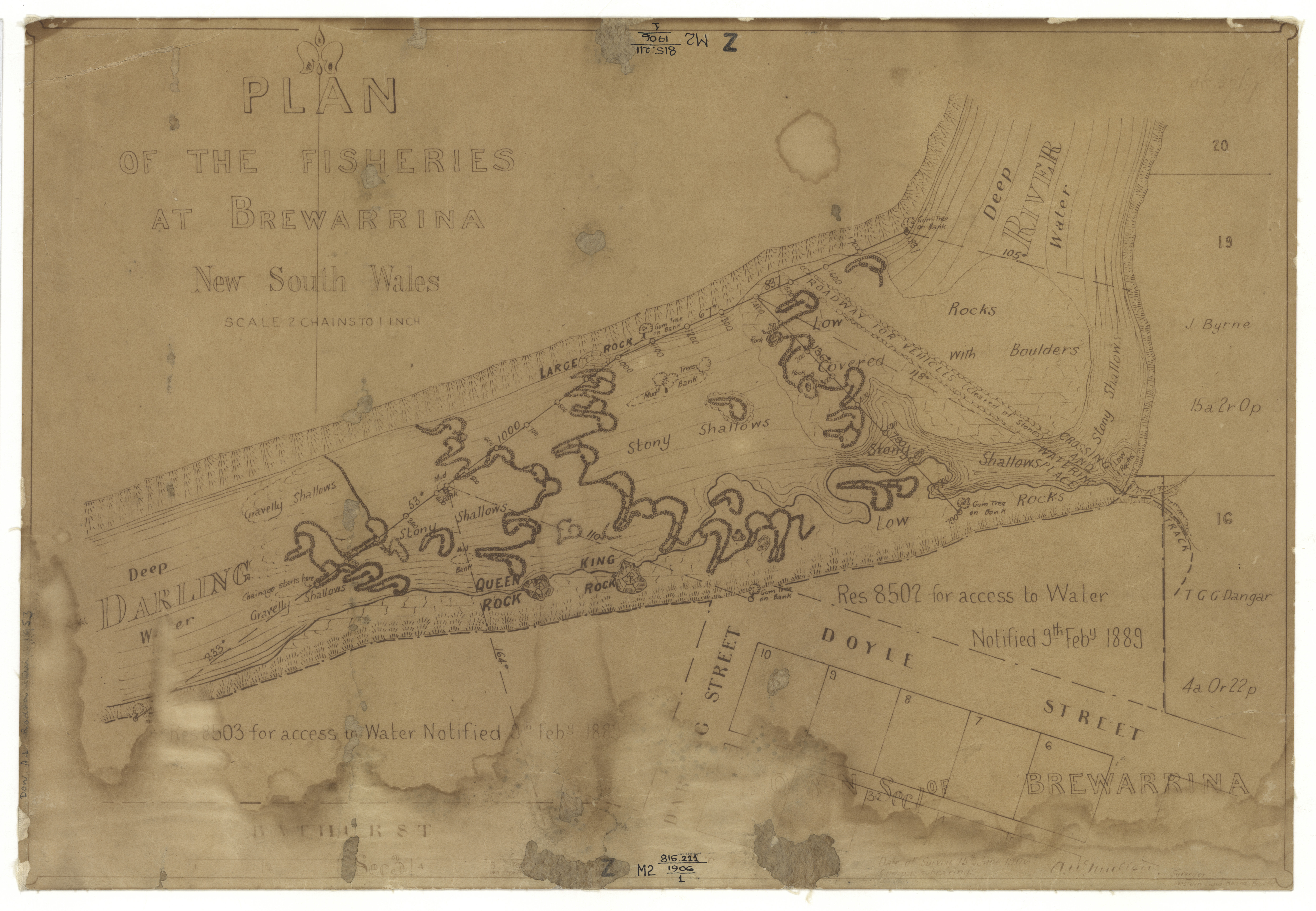
"Res 8503 for access to water notified 9th Feby 1889" ... "Res 8502 for access to water notified 9th Feby 1889"
Area: Covers portion of the Darling River and a portion of the town of Brewarrina N.S.W.
At foot of map: [A] W Mullen, Surveyor Western Land Board; Date of survey 15th June 1906.
Shows topography of part of the Darling River and shoreline, crossing and watering places, track, portions of Brewarrina bordered by Darling, Bathurst and Doyles streets, some numbered porperties with owners names.
Scale [ca. 1:1 584] 2 chains to 1 inch (E 146°52'00--E 146°52'04/S 29°56'54--S 29°57'00). 1 map ; 42 x 28 cm, on sheet 43 x 29.5 cm.
The full catalogue record is online at https://search.sl.nsw.gov.au/primo-explore/fulldisplay?docid=SLNSW_ALMA21120109640002626&vid=SLNSW&search_scope=E&tab=default_tab&lang=en_US&context=L
Brewarrina NSW 2839, Australia.