Coastal Sydney: Plan of the town of Sydney, 1807
Summary:
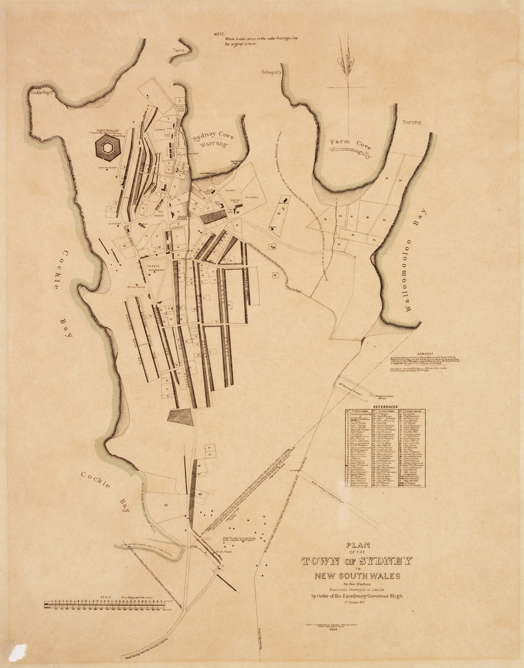
This early map of Sydney demonstrates Aboriginal custodianship through the original names for some of the local landmarks. Description:
Full catalogue record available online at: https://search.sl.nsw.gov.au/primo-explore/fulldisplay?docid=SLNSW_ALMA21106376590002626&vid=SLNSW&search_scope=E&tab=default_tab&lang=en_US&context=L.
Cultural Narrative:
This early map of Sydney demonstrates Aboriginal custodianship through the original names for some of the local landmarks. It was drawn by convict surveyor James Meehan, who was directed by Surveyor General Thomas Livingston Mitchell to note the original placenames of the lands he surveyed. The Aboriginal peoples who provided the information are not named.
Location:
Location Description:
Sydney NSW, Australia.

Community:
Protocol:
Category:
Original Date Description:
1807Contributor:
Language:
GadigalIdentifier:
M2 811.17/1807/3Type:
Format:
Related Digital Heritage Items:

Summary:
Sydney CBD (Gadigal country) from Clark Island; Gamay (Botany Bay).Community:

Summary:
Raymond Ingrey (Dharawal, La Perouse) talks about teaching Dharawal in his community.Community:

Summary:
This painting represents the view east from the Library, towards Car-rang-gel or Garangal (North Head) and Ta-ral-be or Daralbi (South Head).Community:

Summary:
Map of Port Jackson and the town of Sydney, ca. 1857.Community: