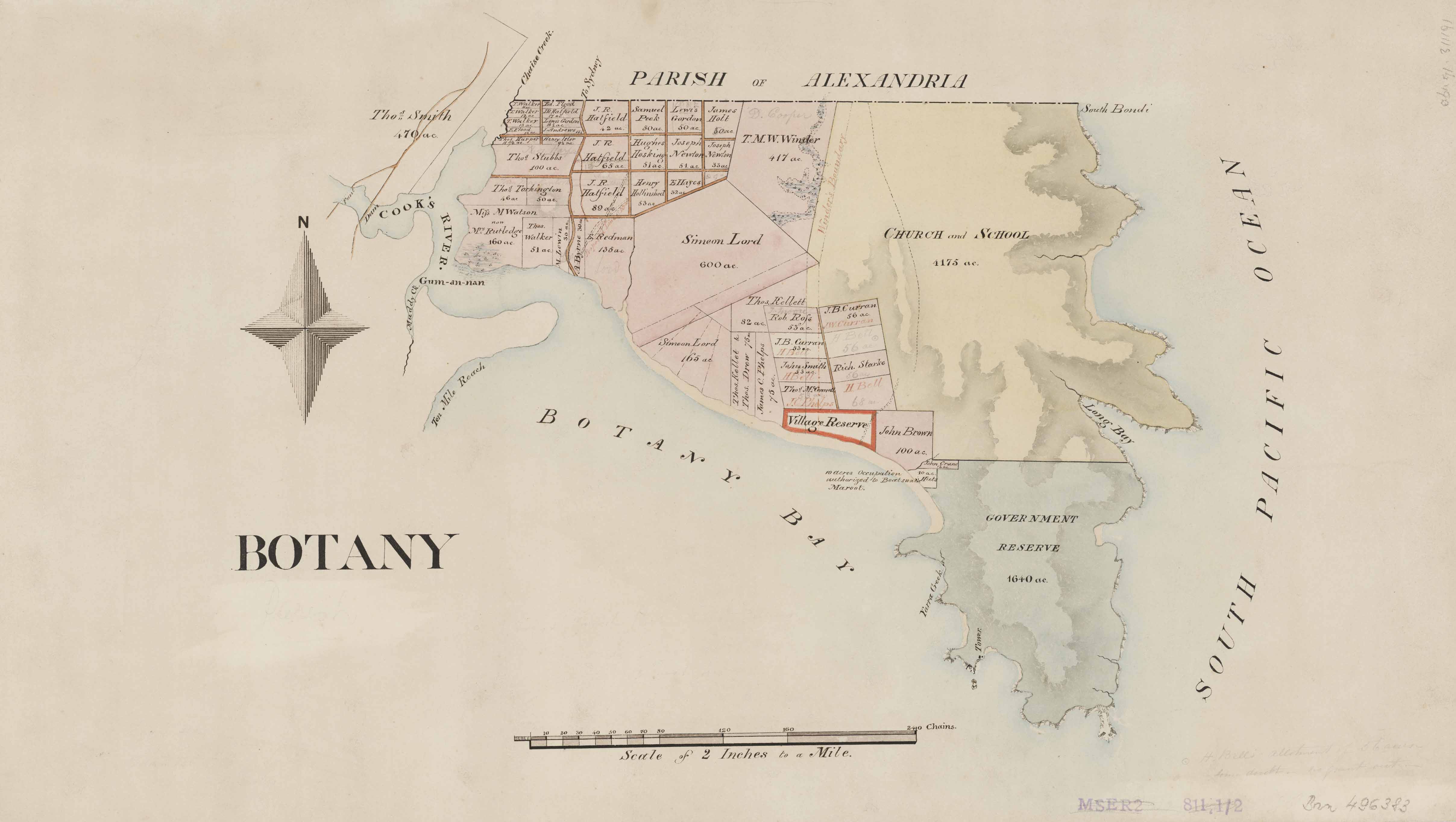
Coastal Sydney: Botany
Dating: [Not before 1840?]: the dam on the Cook's River was completed in 1840.
Manuscript cadastral map of the Parish of Botany, County of Cumberland, N.S.W.
Relief shown by shading.
Shows measured land grants with grantees names, roads and proposed roads, dam, punt, tower, church and school reserve, government reserve, coastline, and islands.
The full catalogue record is online at https://search.sl.nsw.gov.au/primo-explore/fulldisplay?docid=SLNSW_ALMA21137598620002626&vid=SLNSW&search_scope=BJM&tab=default_tab&lang=en_US&context=L.
Dharawal people have been living in and around Gamay (Botany Bay) for tens of thousands of years. From the early 1880s the government actively encouraged Aboriginal people living around Sydney Harbour to move beyond the city limits to La Perouse on the shores of Gamay. By the end of the century most of the Sydney basin Aboriginal people were living there permanently. When the colony of Sydney developed a more industrial lifestyle, Guriwal (La Perouse) and Kamay became the place for city folk to picnic on weekends. As its popularity grew it merited its own tramline, which terminated at La Perouse. Affectionately known as The Loop it was there that Aboriginal men and women sold boomerangs and curios to the picnickers.
Botany Bay, New South Wales, Australia.


